AgriFlyt flies heavy-lift drones to spray, seed, and map the ground crews can't safely or quickly reach — putting product exactly where it's needed and documenting every acre.
The same precision, safety, and recordkeeping — tailored to how each sector buys, operates, and reports.
Vegetation and erosion control on the corridors and sites where ground crews are slow, costly, and exposed to risk.
Scalable rangeland and conservation work for agencies managing large, rugged, and remote acreage.
Faster coverage, less waste, and access to wet or rough fields where ground rigs can't go.
Our DJI Mavic 3 Multispectral maps every acre before we spray, turning imagery into variable-rate and spot-application prescriptions that put product only where it's needed. The same centimeter-scale imagery maps rugged, remote terrain and flags obstacles — keeping flights safe in the backcountry.
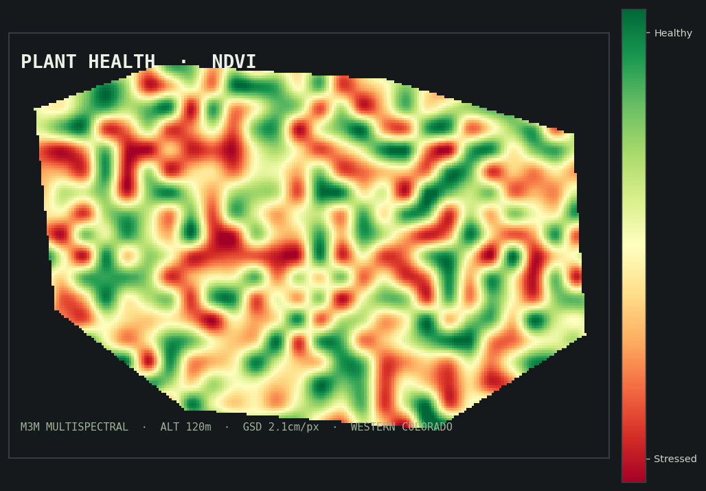
Multispectral imaging reveals stress weeks before the naked eye can — the basis for every prescription.
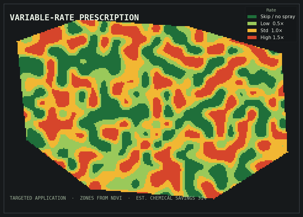
Zone-by-zone rates and spot treatment — full strength where it's needed, skipped where it isn't.
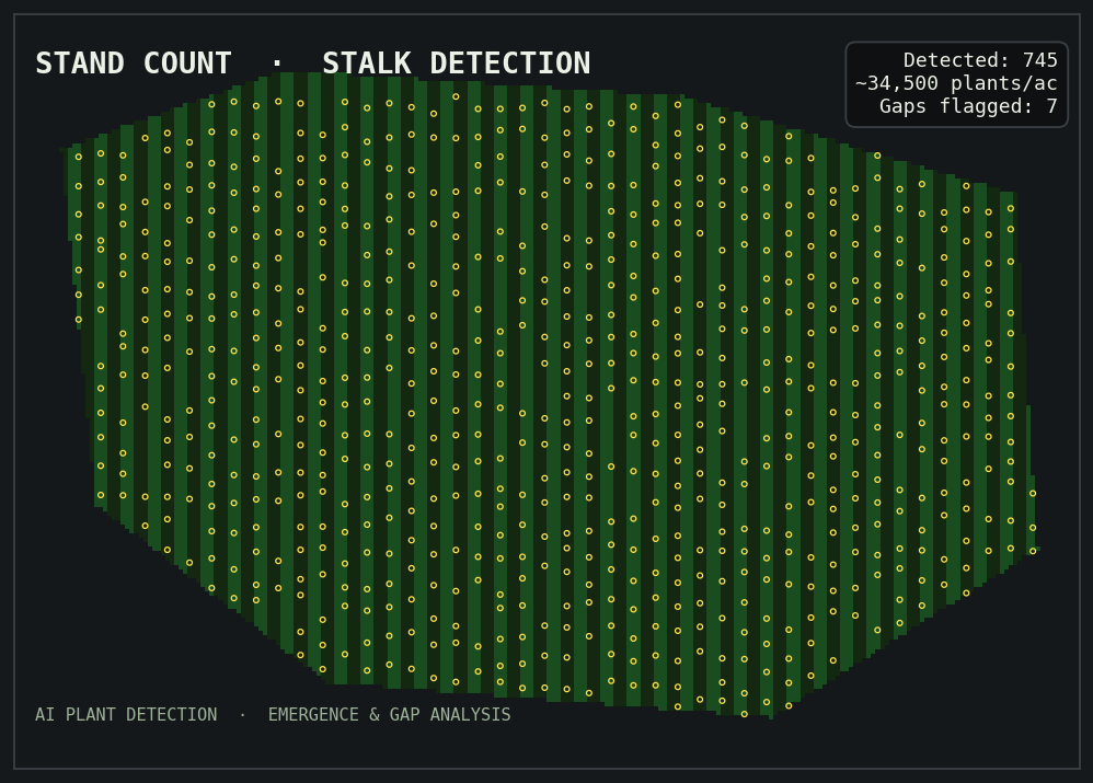
AI plant detection for emergence, gaps, and population — precise counts across difficult ground.
Founded by a licensed manned-aircraft pilot with 20+ years in oil & gas — AgriFlyt brings aviation discipline and industry fluency to every job.
Drones treat steep, remote, and hazardous ground so people don't have to.
RTK-guided application puts product exactly where it's needed — and nowhere it isn't.
As-applied maps, weather, rates, and records for your files and the regulators.
FAA Part 107 & 137, state-licensed applicators, and insured.
Colorado licensing in progress for 2026 · ISN / Avetta / Veriforce-ready · Credentials & capability statement →
A heavy-lift applicator and a multispectral scout — supported by mobile mixing for fresh, compliant batches on site.
We fly DJI's Agras system: centimeter-accurate flight planning, LiDAR and radar obstacle avoidance, and terrain following for the rugged, remote ground our clients operate on. See it work.
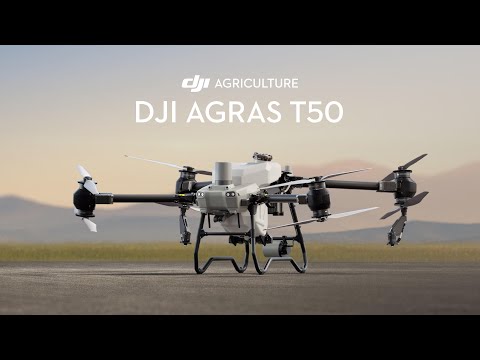
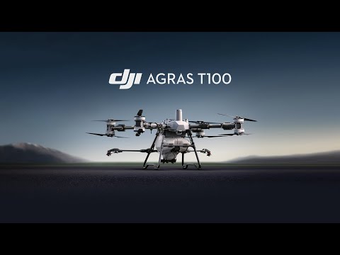
Product footage courtesy of DJI Agriculture. We'll feature AgriFlyt's own field footage here as it's produced.
We assess the site and acreage, with multispectral imaging where it helps.
Precise blends mixed fresh at the job from your prescription.
RTK-guided drone application with active drift management.
As-applied maps and full application records delivered to you.
Based in Grand Junction, Colorado and Richfield, Utah — mobilizing crews and equipment throughout the region.
Tell us about your site or project and we'll follow up to discuss scope, timing, and pricing.